Updates on Hurricane Kiko
- Sep 7, 2025
- 1 min read

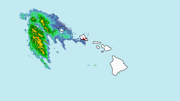
We are closely monitoring Hurricane Kiko and want to keep you informed. At this time, the storm is projected to reach the Hawaiian Islands Monday night into Tuesday morning as a tropical storm. However, storms in Hawaiʻi can change quickly, sometimes shifting course, weakening into a tropical storm, or bringing heavy rain for a day or two afterward.
If your tour is impacted, we will gladly reschedule you to another day. We encourage you to have an alternate date in mind, just in case adjustments are needed. Mahalo for your understanding, and please feel free to call us anytime with questions or concerns.
📞: 808-871-2740

Current Status: September 8th, 2025
Weakened to Category 1
Kiko’s sustained winds are around 85 mph (140 kph) and it's moving northwest at approximately 15 mph (24 kph).
Forecasts indicate Kiko will pass north of the Hawaiian Islands, likely bypassing without landfall.
Avoid ocean activities. Stay out of the water on east-facing beaches. Rip currents and high surf are the biggest risks.


Comments